Digital Landscape Architecture Conference DLA 2021

Virtual Hybrid, May 26 – 28 in Dessau-Köthen-Bernburg

Resilient Landscape Architecture and Global Change

 
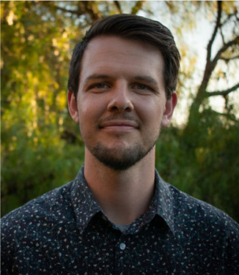
I would have very much liked to greet you in person in Saxony Anhalt. The current situation, of course, allows only for digital meetings. Personal contact and exchange, as well as professional communication – the heart of every conference – must be shifted to the Net. You have all already adjusted to this situation and with this demonstrated your resilience.
 
This brings us to one of the intriguing topics of the conference. Questions about resiliency, about the ability to go through difficult situations without lasting damage, are with view to Climate Change more pressing than ever.

It is imperative that our state, our society, and the natural world meet the great challenges resulting from Climate Change. As agriculture and environmental minister of Saxony Anhalt, it is the forestry and agricultural sectors that are especially of concern to me.

Recently, I presented the 2020 Monitoring Report for Climate Change in Saxony Anhalt. Using selected indicators, the results of climate change monitoring are described and evaluated. These data objectively and statistically demonstrate the changes in climate.

The climate crisis has indeed arrived in Saxony Anhalt. We can perceive and measure these changes. Temperature demonstrates this explicitly: The yearly mean has increased by 1.5° Celsius since 1880. The number of days over 30°C has increased in comparison to the reference period of 1961-1990, and in low-lying regions it has doubled to an average of 14.7 days. The vegetation period has prolonged itself by 13 days and apple trees keep blossoming earlier.

 At the same time, precipitation is lacking. Soil moisture – important for agriculture – has decreased in most regions. Especially in lowlands, local water balance has worsened, which then influences our forests. The unusually long persistent drought which started in April 2018 is now striking higher elevations.

We know what this means: trees can decreasingly defend themselves against pests. This combined with storms means that there are areas in Saxony Anhalt where entire forests are endangered.

We can halt this climate crisis if we act with resolve. Everyone is called upon to help reduce greenhouse gas emissions. This is why the State of Saxony Anhalt adopted the Climate and Energy Concept (KEK) in February 2019. Numerous stakeholders were involved in drawing up and now carrying out this concept, ensuring that the concept will be put into practice with broad civil consensus.

 Simultaneously, we are adapting to the unavoidable consequences of climate change. The Saxony Anhalt State Climate Change Adaptation Strategy started in 2010 is regularly updated with the latest developments and findings. To carry out the resulting measures, working with stakeholders and those affected is of upmost importance.

The Climate and Energy Concept, and the Adaption Strategy are two major building blocks in paving the way to more sustainability in our society. Sustainability is required in all areas of life in order to provide future generations with quality of life. This is why sustainable development is a holistic task for all state organizations in Saxony Anhalt.

 In 2019, the Cabinet of Saxony Anhalt adopted a State Sustainability Strategy. It follows the Agenda 2030 of the United Nations, as well as the German Federal Sustainability Strategy. Part of the State Strategy is an Indicator Report with clear goals to be met by 2030. This offers a myriad of possibilities for landscape architects to actively bring in their ideas to strengthen the resilience of many systems. I look forward to receiving the findings and outcomes of your conference.

A healthy and vital natural environment is one of the keys to meeting the challenges that await us. In this sense, I wish you all an inspiring and successful conference.
 
Prof. Dr. Claudia Dalbert

Workshop 7: Use of UAV for your Environmental Data, Showcases from Malta
Prof. Dr. Savior Formosa, University of Malta

Opening:
Prof. Dr. Claudia Dalbert
Minister for Environment Saxony Anhalt

Session 1A: Resilient Landscape:

Moderation: Prof. Dr. Jörg Rekittke, Norwegian University of Life Sciences (NMBU)
Dr. Ilmar Hurkxkens, ETH Zürich
Shifting Sands: Experimental Robotic Earth-Moving Strategies in Dynamic Coastal Environments
Prof. Dr. Allan W. Shearer, The University of Texas
Conceptualizing a Model of Urban Antifragility for Dense Urban Areas
Dr. Ulrike Wissen Hayek, ETH Zürich
Conceptualizing a Web-based 3D Decision Support System Including Urban Underground Space to Increase Urban Resiliency

Ext. Moderation:

Live Moderation:

Ext. Moderation:

Dr. Stephen Ervin
Harvard University et al

Ext. Moderation:
Prof. Dr. Michael Roth
Hochschule für Wirtschaft und Umwelt Nürtingen-Geislingen (HfWU)

Workshop 6: Applying BIM Workflows to Site Design and Documentation
Oliver Sachs, CAD und BIM-Technology Lecturer at the Department of Architecture at
HTW University Saar
Eric Gilbey, PLA, ASLA, Member APLD, Product Marketing Manager – Landscape of
Vectorworks, Inc.

Impulse:
Dr. Josef Kauer
Chair “BIM DAY GERMANY”

Keynote: How to integrate landscape in the smart city development?

Welcoming Addresses:
Matthias Därr
Landscape Architect, Chamber of Architects
Prof. Dr. Elena Kashtanova
Dean Dep.1, Introduction

Prof. Dr. Thomas H. Kolbe
Technische Universität München

Keynote on International Resilient Landscape Architecture:
Mohan S. Rao
Integrated Design (INDÉ)

Welcoming Address:

Welcoming Address:
Prof. Dr. Jörg Bagdahn
President Anhalt University

Opening Keynote:

Kotchakorn Voraakhom, Chairwoman for Climate Change, (IFLA World), Landprocess,
Addressing Resilient Landscape Architecture and Global Change

Please see the following as introduction: TED in 2018

Workshop 4 B: BIM Features and Landscape Modelling with Lands Design Software

Workshop 4A: BIM features and Landscape Modelling with Lands Design Software

Workshop 3: Applying BIM Workflows to Site Design and Documentation
Eric Gilbey, PLA, ASLA, Member APLD, Product Marketing Manager – Landscape of Vectorworks, Inc.

Workshop 2: UAV in Landscape Architecture
Radim Klepárník

Session 8 - Teaching DLA:

Moderation: Prof. John W. Danahy, University of Toronto
Prof. Dr. Jörg Rekittke, Norwegian University of Life Sciences (NMBU)
Remote Wayfaring and Virtual Fieldwork
Prof. Dr. Travis Flohr, The Pennsylvania State University
Virtual Studio 1.0: A Virtual Tacit-forward Learning Management Framework.
Marc Meijer, Wageningen University and Research
Tangible Landscape: A Waterway Design Education Tool
Wendy Walls, The University of Melbourne
Teaching Urban Landscape Microclimate Design Through Digital Site Visits – A Mosaic Method of Embedding Data, Dynamics, and Experience

Session 5c - BIM+LIM:

Moderation Prof. Dr. Dana Tomlin, University of Pennsilvania
Oliver Engelmayer, Burkhardt | Engelmayer | Mendel Landschaftsarchitekten
IM Pilot Project Digital Start-up Centre Ingolstadt - Applying BIM to Landscape
Andreas Luka, LATI Lab Tsinghua University
Smart BIM Tree: From Design to Construction Site
Prof. Fadi Masoud and Isaac Seah, University of Toronto
Flux.Land: A Data-driven Toolkit For Urban Flood Adaptation

Session 3 - Algorithmic Design:

Moderation: Dr. Agnieszka Ozimek, Cracow University of Technology
Peng Yuyang , TU Delft
A GIS-based Algorithm for Visual Exposure Computation - The West Lake in Hangzhou (China) as Example
Xun Liu, University of Virginia and Hui Tian
Evolution of Historical Urban Landscape with Computer Vision and Machine Learning: A Case Study of Berlin
Phillip Fernberg and Prof. Dr. Brent Chamberlain, Utah State University; Paola Sturla, Politecnico di Milano
Pursuing an AI Ontology for Landscape Architecture

Session 6 - DLA Practice:

Moderation: Dr. Ron van Lammern, Altera Wageningen University
Prof. Ilija Vukorep, BTU Cottbus
Big Scale Landscape Project from Design to Fabrication: A Report on Digital Methods
Daniel Theidel, Hochschule Osnabrück
Searching for New Ways to Design the Landscape
Anita Reith, Hungarian University of Agriculture & Life Sciences
Report of a Remote Participatory Design Process to Renew a Schoolyard During COVID-19

Session 5B - BIM+LIM:

Moderation: Prof Dr. Andreas Thon, Hochschule Geisenheim University
Matthias Remy, Dr. Ilona Brückner, Hochschule Osnabrück
BIM-Modell ‘Open Space Planing’ - A Concept for Landscape Design within Infrastructure Projects
Rüdiger Clausen, GFSL clausen landschaftsarchitekten
BIM in Integrated Construction - a Report
Prof. Yumi Lee. Seoul National University
Holographic Construction of Generative Landscape Design using Augmented Reality Technology

Session 5A: BIM+LIM:
Moderation Prof. Joachim Kieferle, Hochschule Rhein-Main
Mike Shilton, Landscape Institute Digital Practice Group
Digital Futures – BIM in Landscape Architecture: An Update on UK Perspective
Dr. Johannes Gnaedinger, PSU | Prof. Schaller UmweltConsult
Applied Integration of GIS and BIM in Landscape Planning
Laura Wilhelm, Technische Universität München
Integration of BIM and Environmental Planning - The CityGML EnvPlan ADE

Session 7 - UAV:

Moderation: James Melsom, University of Technology Sydney
Radim Klepárník, Mendel University in Brno
UAV Photogrammetry, Lidar or WebGL? A Comparison of Spatial Data Sources for Landscape Architecture
Guifang Wang, Hungarian University of Agriculture and Life Sciences
Ecological Connectivity Networks for Multi-dispersal Scenarios using UNICOR Analysis in Luohe Region, China
Cengiz Akandil, Eastern Switzerland University of Applied Sciences
Mapping Invasive Giant Goldenrod (Solidago gigantea) with Multispectral Images Acquired by UAV

Session 1C - Resilient Landscape:

Moderation: Prof. Andrew Lovett, University of East Anglia
Prof. Peter Stempel, Penn State University
Visualizing Impacts Instead of Inundation for Public Engagement in Coastal Resilience.
Matthias Henning, Anhalt University
A Scenario and Monitoring-based Planning Approach to Strengthen the Resilience of the Region Around the City of Leipzig in Terms of Demographic and Cultural Changes
Dr. Hans-Georg Schwarz-v.Raumer, University ofStuttgart
Development of a Combined Typology to Co-assess Urban Sprawl and Habitat-Network Structure

Session 4B - Geodesign:

Moderation: Prof. Dr. Brian Orland, University of Georgia
Prof. Dr. James Palmer, T. J. Boyle Associates
Visual Prominence of a Solar Energy Project
Prof. Dr. Boris Stemmer, Technische Hochschule Ostwestfalen-Lippe
GIS-Landscape Quality Assessment Using Social Media Data
Widyastri Atsary Rahmy, University of Florida
Landscape Suitability Analysis for Developing a Framework of Green Infrastructure Protection in Bandung Basin Area, Indonesia

Session 4A - Geodesign:

Moderation: Prof. Dr. Thomas Blaschke, University of Salzburg
Benedikt Kowalewski, ETH Zürich
The Site Visit: Towards a Digital in Situ Design Tool
Muge Unal Çilek, Çukurova Üniversitesi
The Effects of Tree Cover Density on Urban Heat Islands in the City of Adana
Luwei Wang and Prof. Dr. Timothy Murtha, University of Florida
How sprawl shapes public parks in an urban system: Spatial analysis of historical urban growth in Orlando Metropolitan Region, Florida, USA

Session 2B - Visualization:

Moderation: Prof. Dr. Eckart Lange, The University of Sheffield
Wei Zhang, Huazhong Agricultural University
The Color Analysis of Building Façades Based on the Panoramic Street View Images
Jeong-Hwan Lee, Seoul National University
Effectiveness of VR Simulation in the Qualitative Analysis of Landscape Lighting Design
Xi Lu, University of Sheffield
Long-term Perspectives of Stakeholders’ Perceptions of Visualisation Media in Participatory Planning: The Case of Sanguan Temple Square in Guangzhou

Session 2A - Visualization:

Moderation: Prof. Hope H. Hasbrouck, University of Texas at Austin
Caroline Fischer, Hochschule für Wirtschaft und Umwelt Nürtingen-Geislingen (HfWU)
Assessing Visual Landscape Sensitivity Towards Wind Turbines with a Distance Decay Effect: An Exploration of Different GIS Approaches
Dr. Christine Fuhrmann, BTU Cottbus
Hanging Gardens - A City Crown for Halle by Walter Gropius in Virtual Reality
Dr. Adam R. Tomkins, The University of Sheffield
"Where the Wild Things Will Be: Adaptive Visualisation with Spatial Computing"

Session 1B: Resilient Landscape:

Prof. Dr. Steffen Nijuis, TU Delft
Prof. Emily Schlickman, University of California, Davis
Prototyping a Low-Cost Sensor Network to Better Understand Hyperlocal Air Quality Patterns for Planning and Design
Prof. Dr. Pia Fricker, Yao Chaowen, Aalto University
32° C “HeLLsinki” - Outdoor Thermal Comfort Studies and Urban Mitigating Strategies Based on the Context of Helsinki
Prof. Aidan C. Ackerman, Ashley Crespo, John Auwaerter SUNY ESF Syracuse
Using Tree Modeling Applications and Game Design Software to Simulate Tree Growth, Community Interaction, and Mortality

Session 1A: Resilient Landscape:

Moderation: Prof. Dr. Jörg Rekittke, Norwegian University of Life Sciences (NMBU)
Dr. Ilmar Hurkxkens, ETH Zürich
Shifting Sands: Experimental Robotic Earth-Moving Strategies in Dynamic Coastal Environments
Prof. Dr. Allan W. Shearer, The University of Texas
Conceptualizing a Model of Urban Antifragility for Dense Urban Areas
Dr. Ulrike Wissen Hayek, ETH Zürich
Conceptualizing a Web-based 3D Decision Support System Including Urban Underground Space to Increase Urban Resiliency